Phnom Kulen History: Birthplace of the Khmer Empire and the Lost City (Mahendraparvata)
A stone plateau north of Siem Reap, a king who declared himself a god-king in 802 CE, and a whole city that slept under jungle for a thousand years until aircraft found it again.
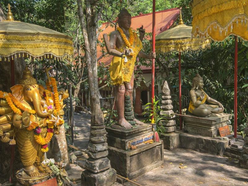
From a mountain throne to a lost city: the Khmer timeline
Dates follow the whitelisted Wikipedia entries for Phnom Kulen, Mahendraparvata and Jayavarman II.
Planning takeaway: Visit sacred sites with historical context; remote Rong Chen requires another itinerary.
Why is Phnom Kulen called the birthplace of the Khmer Empire?
In 802 CE, on this sandstone plateau, King Jayavarman II held a ceremony that proclaimed him universal monarch and cut the land free from Java. That act founded the Khmer Empire, the civilisation that would raise Angkor. The mountain, known then as Mahendraparvata, held one of its earliest royal capitals.
Choose the kind of mountain day first, then compare current inclusions and the time you have.
Cambodians do not treat this as a footnote. The whole imperial line that later carved Angkor Wat traces its beginning to a rite performed up here, above the plain where the temples now stand. The name Mahendraparvata means the mountain of the great Indra, which tells you how the place was read: not a fort, but a holy high point close to the gods. The team at Phnom Kulen Tours books the trips that make this an easy day out.
The mountain was chosen for reasons that still make sense when you stand on it. Water rises here and runs down to feed the rice country below, and high ground carried weight in a religion built around sacred peaks. That is the short version of why Jayavarman II chose this mountain for so charged a ceremony. The modern name, Phnom Kulen, is gentler and means the mountain of the lychees.
Holiness here has never belonged to one faith. The plateau is sacred to Hindus, who left carved rivers and lingas, and to Buddhists, who added the great reclining figure many centuries later. If you want the practical layout of the park before the history, the complete national park guide sets out the sites and the day.
The mountain has never gone quiet. Cambodians still climb it to pray at the hilltop pagoda, leave offerings, and bathe in water that ran across the sacred carvings upstream. That living devotion is part of what you visit. You are not walking a dead monument but a working pilgrimage site that happens to be twelve centuries old, which is why quiet and modest dress matter at the Buddha and the shrines.
What actually happened on the mountain in 802 CE?
Jayavarman II staged a consecration that declared him a chakravartin, a world-ruling king, and severed the region's ties to Java. It fused royal power with the divine and set the template every later Khmer monarch followed. The exact ritual is debated by scholars, but the political result is not: a unified kingdom was born.
Picture the moment less as a coronation and more as a declaration of independence wrapped in ritual. Before it, the land was a patchwork of local lords, some paying respect to distant Java. After it, one king claimed authority over all of them and grounded that claim in a god-king cult that made the ruler the pivot between heaven and earth.
That idea travelled well. The temple-mountains of Angkor, the reservoirs, the god-king imagery, all of it grew from the seed planted on Phnom Kulen. Within a few generations the royal seat moved off the plateau, first down to the Roluos area on the plain and later to the Angkor plain itself, where the famous temples rose. The mountain kept its sacred rank even as the palaces moved on.
Historians reconstruct the ceremony mainly from later inscriptions rather than any eyewitness account, so the fine detail stays open to debate. The outcome is not. From this moment the Khmer kings ruled as god-kings, and the whole apparatus of temple-building, water control and divine kingship that shaped the next six centuries traces back to the claim staked on this plateau.
Guides who work the mountain tell this story on the way up, because it changes how the carvings and the ruins land. A private day built around it, such as a private historical wonders tour, gives the driving hours over to the narrative rather than to a checklist of photo stops.
What was Mahendraparvata, the lost city?
Mahendraparvata was an early Khmer royal capital laid out across the Phnom Kulen plateau in the ninth century. For a long time historians knew it existed from inscriptions but could not see its shape, because forest had swallowed the streets, shrines and water works. It sat hidden above Angkor for roughly twelve hundred years.
The word capital can mislead. This was not a walled stone metropolis in the European sense. It was a spread-out settlement of shrines, embankments, ponds and house mounds, organised on a plan and served by managed water, the same obsession with hydraulics that later defined Angkor. Timber and thatch rot in this climate, so the everyday city vanished while the stone and the earthworks stayed as faint traces.
| Where Khmer power sat | Rough era | Where it is today | What survives to visit |
|---|---|---|---|
| Mahendraparvata (Phnom Kulen) | early 9th century | the plateau, about 40 km northeast of Siem Reap | carved riverbeds, shrines, earthworks under forest |
| Roluos area, on the plain | later 9th century | southeast of modern Siem Reap | early brick temples |
| The Angkor plain | 10th century onward | the Angkor park | Angkor Wat, Angkor Thom, the Bayon |
So the mountain was the first act, and Angkor was the long, spectacular sequel. Standing on Phnom Kulen, you are standing at the top of that story rather than at its most photographed chapter.
The word capital does more harm than good here for another reason. Nothing about the plateau looks metropolitan today. You walk forest, cross a carved stream, meet a boulder Buddha, and that is the visible city. The rest, the grid the lasers found, sits under leaf litter and root, sensed rather than seen, which is a strange and rather moving thing to stand inside.
How did lidar reveal the lost city in 2012 and 2013?
In 2012 and 2013, survey aircraft flew over the plateau firing laser pulses at the ground, a technique called lidar. The lasers slip between leaves and record the bare earth beneath, so the forest effectively disappears from the data. What appeared was the street grid and water works of Mahendraparvata, mapped at a scale nobody had seen before.
The strength of lidar is exactly the thing that had defeated researchers on foot: canopy. From the ground you see trees and a few carved boulders. From the air, with the leaves stripped away in the data, you see the deliberate geometry of a planned settlement, lines that only human hands produce.
The finding did not invent the city out of nothing. Inscriptions and scattered ruins had long pointed to a royal presence up here. What the survey delivered was scale and plan, turning a suspected capital into a mapped one. It reframed Phnom Kulen from a pilgrimage day trip into one of the more important archaeological landscapes in Southeast Asia, without a single new temple being dug up.
Very little of that mapped grid is visitor-facing. You will not walk labelled ruins of a downtown. The reward on the ground is different: carved rivers, boulder sculptures and the reclining Buddha, set in the forest that hid the rest.
The same laser method has since redrawn the map of Angkor itself, so Phnom Kulen sits at the start of a survey revolution as well as at the start of the empire. For a visitor the lesson is humility. Most of what made this place a capital remains unexcavated and effectively invisible, so the trip is partly an act of imagination, filling the forest with a city you cannot quite see.
What history can you actually see on the mountain today?
Three things carry the visit: the River of a Thousand Lingas, a sandstone streambed carved with Shiva symbols and Hindu gods; the 16th-century reclining Buddha at the Preah Ang Thom pagoda, cut into a single boulder; and Srah Damrei, a remote field of life-size stone animals, including a full elephant, deep in the park.
The carved river is the oldest layer you can stand over. Lingas, the symbols of Shiva, cover the sandstone bed along with figures of Hindu deities, and the belief is that the water is blessed as it passes across them on its way down to the plains. For the full account of the carvings, see the carved River of a Thousand Lingas, and if you want it on foot there is guided Kulen rainforest trekking itinerary.
| Site | What it is | Roughly when | Easy on a day trip? |
|---|---|---|---|
| River of a Thousand Lingas | carved streambed of lingas and deities | 9th to 11th century | Yes, a standard stop |
| Preah Ang Thom reclining Buddha | giant Buddha carved into one boulder, at the hilltop pagoda | 16th century | Yes, the busiest stop |
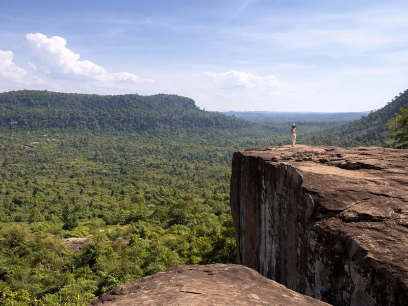
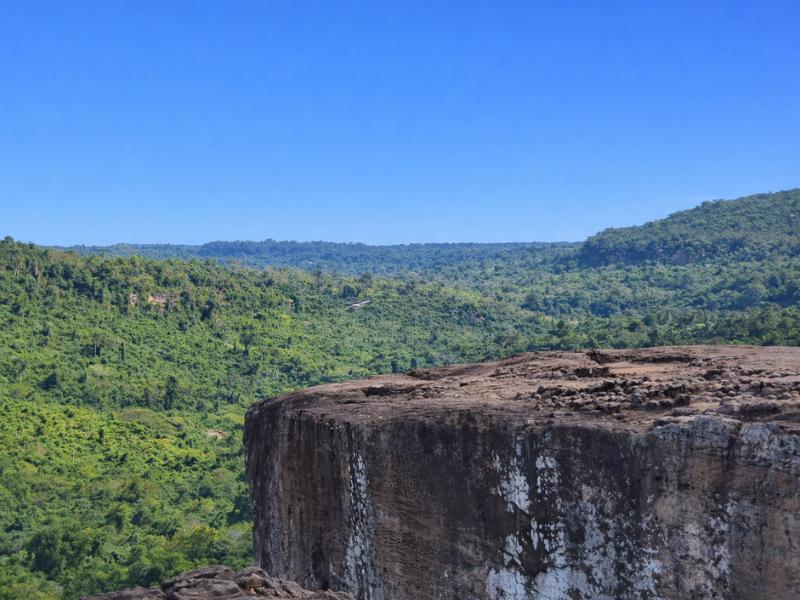
| Poeng Ta Kho | a cliff viewpoint on the plateau | Angkor era | On some itineraries |
| Srah Damrei (Elephant Pond) | life-size stone elephant and animals | Angkor era | No, remote, needs a dedicated trip |
The reclining Buddha is younger than most people assume. It was carved in the 16th century, long after Angkor's peak, which is why it counts as one of Cambodia's largest reclining Buddhas rather than an original imperial work. Srah Damrei is the one that rewards effort: it sits far out on the plateau and most day tours cannot reach it, so treat it as a special mission, not a casual add-on.
That access reality is worth stating plainly. Reaching the stone elephant means a long, rough approach that eats hours, and it is usually a trek or a dedicated private trip rather than a stop on a group day. Go only if remote carvings genuinely thrill you. Otherwise the carved river, the falls and the Buddha are the honest core of the visit, and they are all easy to reach.
How does Phnom Kulen connect to the temples below?
Everything at Angkor descends from the idea launched here. The god-king cult, the temple-mountain form, the fixation on water management, all first took royal shape on Phnom Kulen before the capital moved down to the plain. The mountain is the source; Angkor is where the source was built out in stone at enormous scale.
There is a physical link too. The mountain feeds rivers that run down toward the Angkor lowlands, and control of that water underpinned the farming that fed the imperial city. Sacred and practical overlap: the same streams that were blessed over the carved lingas watered the rice that paid for the temples.
For a traveller, this makes a strong pairing rather than a competition. Many people climb the mountain for the origin story and then spend other days on the temple plain for the payoff. If you are weighing the logistics of doing both, our note on how to pair the mountain with Angkor Wat lays out the realistic options, and a straightforward starting point is simply how to reach the mountain from Siem Reap.
One honest correction while we are here. Phnom Kulen is a national park with its own separate entry fee, and it is not part of the Angkor World Heritage listing. People conflate the two constantly, then arrive expecting their Angkor pass to cover the mountain. It does not.
A few other myths cling to the mountain, so here is the honest version of each.
| You may have heard | The honest version |
|---|---|
| Phnom Kulen is part of the Angkor UNESCO site | It is a separate national park with its own twenty dollar fee |
| The lost city was unknown until 2012 | Its existence was long suspected; lidar mapped its scale in 2012 and 2013 |
| The reclining Buddha is ancient Angkor work | It was carved in the 16th century, well after Angkor's peak |
| The mountain is only a Hindu site | It is holy to both Hindus and Buddhists |
A history-first day on the mountain, hour by hour
A history-led day spends less time rushing between photo spots and more time letting a guide join the dots. A typical shape: pickup around eight, up the access road, the carved river and its meaning first, then the waterfall, lunch, the reclining Buddha, and a viewpoint before the drive down. Roughly nine to ten hours door to door.
The reason to book a guided version rather than a self-drive is not comfort alone. The access road up the mountain has historically run one way, up in the morning and down after midday, so a good operator plans the day around that window. Your driver handles the timing while you concentrate on the story. A full day-trip itinerary is set out separately if you want the general plan without the history focus.
| Time | Where you are | The history in front of you |
|---|---|---|
| 08:00 | hotel pickup in Siem Reap | the drive itself, plateau rising ahead |
| 09:30 | up the access road | you are climbing to the empire's birthplace |
| 10:00 | River of a Thousand Lingas | Hindu carvings blessing the water |
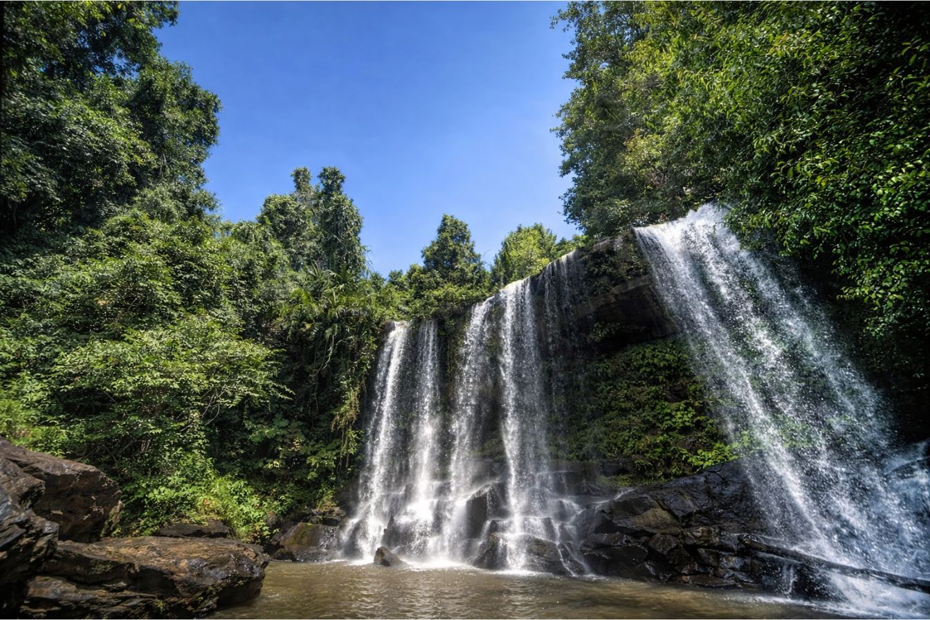
| 11:30 | the two-tier waterfall | a swim, the natural break in the day |
| 12:30 | picnic lunch near the falls | local palm sugar and cakes nearby |
| 13:30 | Preah Ang Thom pagoda | the 16th-century reclining Buddha |
| 14:30 | a cliff viewpoint | the plain the empire later filled with temples |
| 16:00 to 18:00 | drive back to Siem Reap | time to let the day settle |
Three trips carry the history especially well, and they differ mainly in pace and privacy. Read the prices as recent starting rates and check the live listing before booking.
| Tour | Style | Length | Best for |
|---|---|---|---|
| Private historical wonders tour | private car and guide | 8 hours | a story-led full day, around $99 |
| Kulen ticket and Banteay Srei tour | small-group, adds a temple | 9 hours | carvings with context, around $52 |
| 1000 Lingas uphill trek | private hike to the summit | 8 hours | seeing the carvings on foot, around $82 |
A history-weighted trip that also folds in the exquisite carvings of a nearby temple is a day that adds Banteay Srei temple, which puts the mountain's origin and a masterpiece of later Khmer stonework in the same outing.
Who should skip a history-focused Kulen trip?
Skip the deep-history version if your idea of a good day is a quick swim and a fast return, or if you are museum-weary after several days of temples. The mountain rewards patience and context. Without a guide narrating it, the carved river can read as scratches in rock, and the long drive can feel like a lot for a short dip.
Be honest with yourself about temple fatigue. Travellers who have already spent three or four days on the Angkor plain sometimes hit the mountain running on empty and feel underwhelmed. If that is you, either give it a rest day first, or pick a trip that leads with the waterfall and treats the history as a bonus rather than the main event.
There is also a slower, richer way to do it that sidesteps the fatigue problem. Spread the mountain across a longer visit on the trekking and hiking route, camping on the plateau, and the history stops competing with a ticking clock. That suits hikers and photographers far more than a rushed group van, and it turns the lost-city idea from a slogan into something you feel underfoot overnight.
The remote sculptures are their own filter. Srah Damrei and the further ruins take real effort to reach, so anyone hoping to tick them off on a standard van tour will be disappointed. Those belong to trekkers and to private trips with time to spare, not to a nine-hour group day.
Finally, weigh the fee against your interests. The separate twenty dollar park entry buys the history, the carvings and the falls together. If none of the origin story moves you and you only want water, other options near town may suit better, and our take on other waterfalls near Siem Reap is worth a look before you commit the whole day.